Saturna Island Overview
Saturna Island is a mountainous island, about 31 km² in size, in the southern Gulf Islands chain of British Columbia. It is situated approximately midway between the Lower Mainland of B.C. and Vancouver Island, and is the most easterly of the Gulf Islands. It is surrounded on three sides by the Canada/USA border. To the north is Point Roberts, Washington State, and to the east and south are the San Juan Islands. Saturna has a permanent population of around 350, although that number increases significantly during the busy summer season. Approximately half of the island is in the new Gulf Islands National Park Reserve that was formed in 2003 from 2 provincial parks, an Ecological Reserve, and other Crown land (i.e. land owned by the province).
Island History
The island was first used by indigenous people who called the island “Long Nose,” due to the island’s long north-eastern tapering shoreline that ends at East Point. The name Saturna comes from the ship Santa Saturnina (“St. Saturnina”), commanded by Captain José MarÃa Narváez and Pilot Juan Carrasco in 1791. The first European settlers came in the 1800s, but the island was slower to develop than the neighbouring Gulf Islands due to its relative isolation and rugged topography.
Parks & Beaches
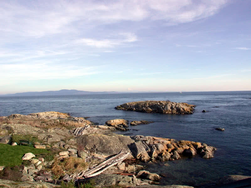
Many beaches also grace Saturna Island. The sandy Thomson Park provides a perfect place to swim and relax. Russell Reef, off East Point Road, showcases a natural swimming hole. And at East Point Regional Park, the shoreline ranges from flat and shelly to sloping and rocky. Mount Warburton Pike, Saturna’s highest point (and the highest summit in the Gulf Islands excluding the peaks on Saltspring Island), and the nearby Brown Ridge Trail offer spectacular views of the Gulf Islands. Another short hike leads you to picturesque Narvaez Bay, where there is a perfect view of the San Juan Islands.